Our Services
Groma provides consulting, 3D scanning, data processing, and digital curation services for projects that require accurate, interpretable spatial documentation. Services are structured to support the full lifecycle of spatial data from planning and capture through analysis and long-term stewardship.
Rather than offering fixed packages, work is scoped to project goals, scale, and intended use.
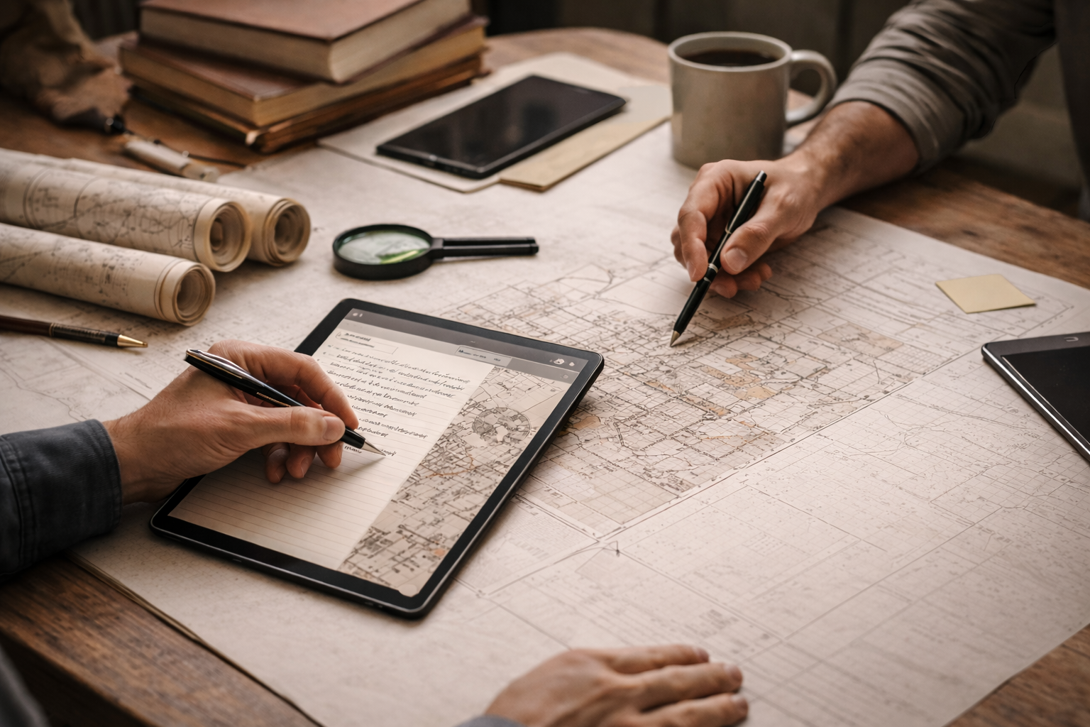
Consulting & Project Planning
Groma provides consulting services to support the planning, design, and oversight of spatial documentation projects. Consulting focuses on defining scope, selecting appropriate capture methods, and establishing clear workflows before data collection begins.
Services may include:
Project scoping and feasibility assessment
Method and workflow design
Equipment and capture strategy selection
Data standards and deliverable planning
Advisory support for heritage, research, and applied projects
Consulting can be provided independently or as part of a larger documentation effort.
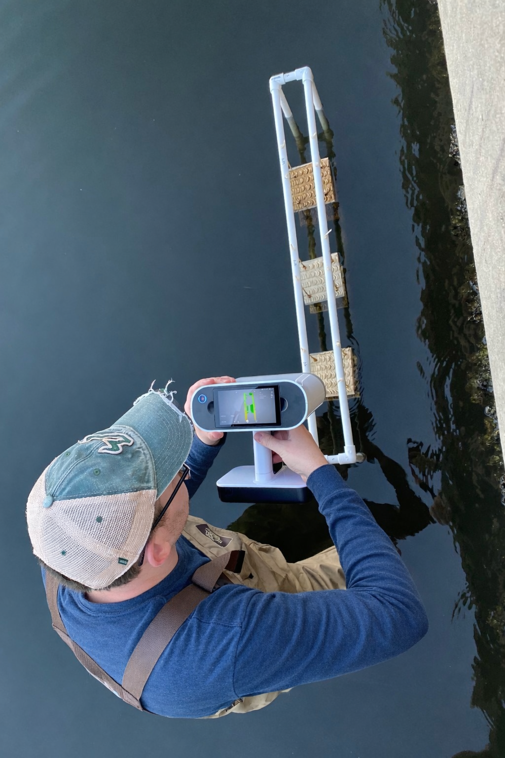
3D Scanning & Spatial Capture
Groma conducts high-resolution 3D scanning and spatial data capture for objects, spaces, and sites. Capture methods are selected based on scale, context, and intended analytical use rather than a one-size-fits-all approach.
Services may include:
Object-level and artifact scanning
Terrestrial and site-scale scanning
Control, alignment, and spatial referencing
Field documentation support
All capture work is performed with attention to accuracy, context, and downstream usability.
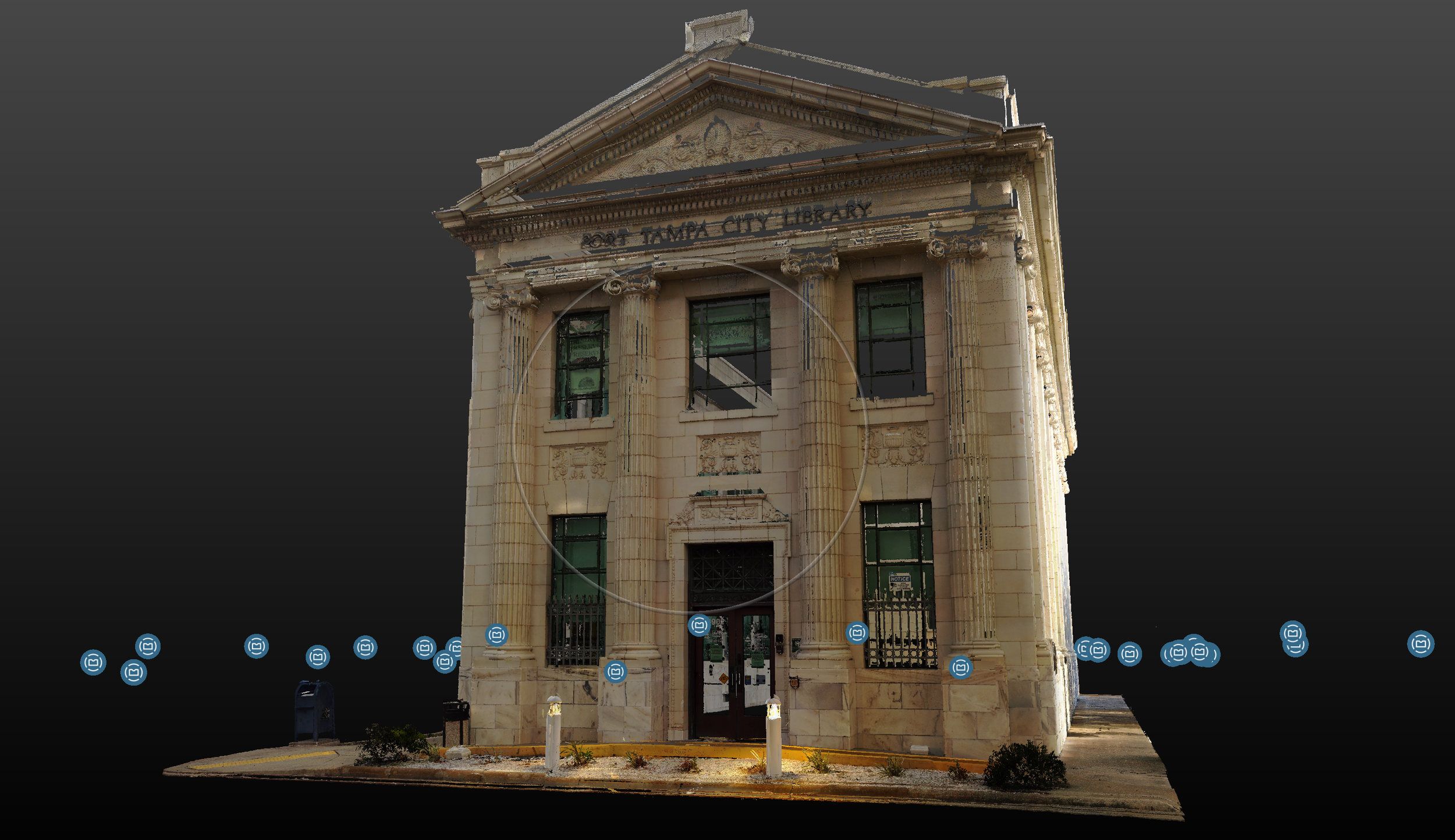
Processing, Analysis, & Digital Curation
Groma provides processing, analysis, and digital curation services to ensure spatial datasets are accurate, interpretable, and usable over time. This work emphasizes structure, documentation, and responsible data handling rather than visual output alone.
Services may include:
Registration, alignment, and cleanup
Analytical preparation of spatial datasets
File organization and delivery structuring
Metadata creation and documentation
Digital asset preparation for long-term use or integration
These services support research, interpretation, reporting, and archival needs.
Contact us
If you are planning a project involving consulting, 3D scanning, spatial analysis, or digital curation, please get in touch to discuss scope, methods, and timeline. Initial inquiries are reviewed personally, and responses are typically provided within one to two business days.
Email
fawbusha@gromaanalytical.com
Location
Florida, USA
(Projects supported remotely and on site)